![](/images/other/stat-length.png)
![Randonnée Marche nordique Les Portes du Coglais - montnoël échelle - Photo](https://media.geolcdn.com/t/1900/400/ext.pjpeg?maxdim=2&url=https%3A%2F%2Fstatic1.geolcdn.com%2Fsiteimages%2Fupload%2Ffiles%2F1545311037marcheuse_200dpi.jpg)
montnoël échelle
coglais
Utilisateur
![Longueur](/images/other/stat-length.png)
Longueur
11,2 km
![Altitude max](https://static1.geolcdn.com/siteimages/upload/files/1508320355ic_sort_altitude_max_24dp.png)
Altitude max
170 m
![Dénivelé positif](https://static1.geolcdn.com/siteimages/upload/files/1508320355ic_sort_den_pos_24dp.png)
Dénivelé positif
135 m
![Km-Effort](/images/other/stat-length.png)
Km-Effort
13 km
![Altitude min](https://static1.geolcdn.com/siteimages/upload/files/1508320355ic_sort_altitude_min_24dp.png)
Altitude min
123 m
![Dénivelé négatif](https://static1.geolcdn.com/siteimages/upload/files/1508320355ic_sort_den_neg_24dp.png)
Dénivelé négatif
138 m
![Boucle](https://static1.geolcdn.com/siteimages/upload/files/16400158638029165_repeat_loop_refresh_sync_direction_icon.png)
Boucle
Oui
Date de création :
2016-11-04 00:00:00.0
Dernière modification :
2021-10-15 09:04:02.43
![Marche nordique](https://static1.geolcdn.com/sitytour/trail-icons/102.png)
2h00
Difficulté : Moyen
![Scannez ce code QR pour ouvrir la randonnée dans l'application SityTrail](https://capi.geolives.com/qq0zvz2zws4bq2lad0pu/sitytour/trails/356601/qr.png?size=200)
Application GPS de randonnée GRATUITE
À propos
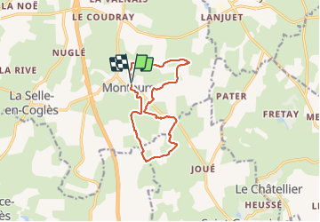
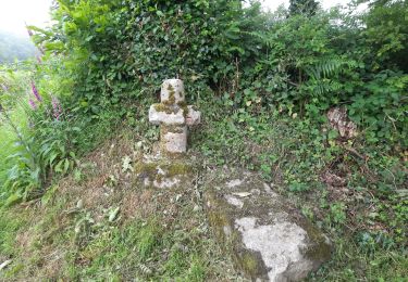
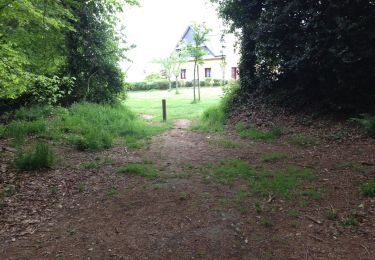
Randonnée Marche nordique de 11,2 km à découvrir à Bretagne, Ille-et-Vilaine, Les Portes du Coglais. Cette randonnée est proposée par coglais.
Description
départ de la salle du clos breton à Montours par le sentier du Mont-Noël et retour par le haut des Echelles
Localisation
Pays :
France
Région :
Bretagne
Département/Province :
Ille-et-Vilaine
Commune :
Les Portes du Coglais
Localité :
Montours
Départ:(Dec)
Départ:(UTM)
625228 ; 5366945 (30U) N.
Commentaires
Randonnées à proximité
![Randonnée A pied Les Portes du Coglais - A l'Orée de Gâtines - Photo](https://media.geolcdn.com/t/375/260/d6721d0a-145f-4a76-a5a3-8af3818a7e42.jpeg&format=jpg&maxdim=2)
![A pied A pied](https://static1.geolcdn.com/sitytour/trail-icons/100.png)
A l'Orée de Gâtines
A pied
Moyen
Les Portes du Coglais,
Bretagne,
Ille-et-Vilaine,
France
![](/images/other/stat-length.png)
19,5 km | 22 km-effort
5h 2min
![](https://static1.geolcdn.com/siteimages/upload/files/16400158638029165_repeat_loop_refresh_sync_direction_icon.png)
Oui
![Randonnée A pied Le Châtellier - Le Chatellier - le cirque du Diable - Photo](https://media.geolcdn.com/t/375/260/5ed848be-956b-4ee2-b198-d6e89ae86cbe.jpeg&format=jpg&maxdim=2)
![A pied A pied](https://static1.geolcdn.com/sitytour/trail-icons/100.png)
Le Chatellier - le cirque du Diable
A pied
Facile
Le Châtellier,
Bretagne,
Ille-et-Vilaine,
France
![](/images/other/stat-length.png)
5,9 km | 7,1 km-effort
1h 37min
![](https://static1.geolcdn.com/siteimages/upload/files/16400158638029165_repeat_loop_refresh_sync_direction_icon.png)
Oui
![Randonnée Marche Maen-Roch - Saint-Brice-en-Coglès / la marche des châteax - Photo](https://media.geolcdn.com/t/375/260/ext.jpg?maxdim=2&url=https%3A%2F%2Fstatic1.geolcdn.com%2Fsiteimages%2Fupload%2Ffiles%2F1553511878bg_sport_marche.png)
![Marche Marche](https://static1.geolcdn.com/sitytour/trail-icons/101.png)
Saint-Brice-en-Coglès / la marche des châteax
Marche
Facile
(1)
Maen-Roch,
Bretagne,
Ille-et-Vilaine,
France
![](/images/other/stat-length.png)
10,8 km | 12,3 km-effort
2h 41min
![](https://static1.geolcdn.com/siteimages/upload/files/16400158638029165_repeat_loop_refresh_sync_direction_icon.png)
Oui
![Randonnée Marche Le Châtellier - GR_37_AE_19_Chatellier_Fougeres_20210618 - Photo](https://media.geolcdn.com/t/375/260/86e0ada0-a5bb-4e42-a786-1c56487d1d50.jpg&format=jpg&maxdim=2)
![Marche Marche](https://static1.geolcdn.com/sitytour/trail-icons/101.png)
GR_37_AE_19_Chatellier_Fougeres_20210618
Marche
Facile
Le Châtellier,
Bretagne,
Ille-et-Vilaine,
France
![](/images/other/stat-length.png)
19 km | 23 km-effort
4h 58min
![](https://static1.geolcdn.com/siteimages/upload/files/16400158638029165_repeat_loop_refresh_sync_direction_icon.png)
Non
![Randonnée Marche Maen-Roch - GR_37_AD_18_Maen-Roch_Chatellier_20210617 - Photo](https://media.geolcdn.com/t/375/260/56ae4420-e2b7-430d-926e-ac51a85b9df3.jpg&format=jpg&maxdim=2)
![Marche Marche](https://static1.geolcdn.com/sitytour/trail-icons/101.png)
GR_37_AD_18_Maen-Roch_Chatellier_20210617
Marche
Facile
Maen-Roch,
Bretagne,
Ille-et-Vilaine,
France
![](/images/other/stat-length.png)
17,8 km | 21 km-effort
4h 31min
![](https://static1.geolcdn.com/siteimages/upload/files/16400158638029165_repeat_loop_refresh_sync_direction_icon.png)
Non
![Randonnée Marche nordique Les Portes du Coglais - montours pontbesnard chênesec11km - Photo](https://media.geolcdn.com/t/375/260/ext.jpg?maxdim=2&url=https%3A%2F%2Fstatic1.geolcdn.com%2Fsiteimages%2Fupload%2Ffiles%2F1545311037marcheuse_200dpi.jpg)
![Marche nordique Marche nordique](https://static1.geolcdn.com/sitytour/trail-icons/102.png)
montours pontbesnard chênesec11km
Marche nordique
Moyen
(1)
Les Portes du Coglais,
Bretagne,
Ille-et-Vilaine,
France
![](/images/other/stat-length.png)
11,3 km | 13,1 km-effort
2h 30min
![](https://static1.geolcdn.com/siteimages/upload/files/16400158638029165_repeat_loop_refresh_sync_direction_icon.png)
Oui
![Randonnée Marche nordique Les Portes du Coglais - Montours talvassais 7,5km - Photo](https://media.geolcdn.com/t/375/260/ext.jpg?maxdim=2&url=https%3A%2F%2Fstatic1.geolcdn.com%2Fsiteimages%2Fupload%2Ffiles%2F1545311037marcheuse_200dpi.jpg)
![Marche nordique Marche nordique](https://static1.geolcdn.com/sitytour/trail-icons/102.png)
Montours talvassais 7,5km
Marche nordique
Moyen
(1)
Les Portes du Coglais,
Bretagne,
Ille-et-Vilaine,
France
![](/images/other/stat-length.png)
7,6 km | 8,8 km-effort
2h 0min
![](https://static1.geolcdn.com/siteimages/upload/files/16400158638029165_repeat_loop_refresh_sync_direction_icon.png)
Oui
![Randonnée Marche nordique Saint-Germain-en-Coglès - stgermain légende heussé 12,5km - Photo](https://media.geolcdn.com/t/375/260/ext.jpg?maxdim=2&url=https%3A%2F%2Fstatic1.geolcdn.com%2Fsiteimages%2Fupload%2Ffiles%2F1545311037marcheuse_200dpi.jpg)
![Marche nordique Marche nordique](https://static1.geolcdn.com/sitytour/trail-icons/102.png)
stgermain légende heussé 12,5km
Marche nordique
Très facile
(1)
Saint-Germain-en-Coglès,
Bretagne,
Ille-et-Vilaine,
France
![](/images/other/stat-length.png)
12,5 km | 15,4 km-effort
2h 30min
![](https://static1.geolcdn.com/siteimages/upload/files/16400158638029165_repeat_loop_refresh_sync_direction_icon.png)
Oui
![Randonnée Marche nordique Le Châtellier - Le Châtellier Péroussel - Photo](https://media.geolcdn.com/t/375/260/ext.jpg?maxdim=2&url=https%3A%2F%2Fservices.sitytrail.com%2FGeolivesWS%2FDownloadMedia.ashx%3FTrailID%3D421393%26Media%3D20150510103549.jpg)
![Marche nordique Marche nordique](https://static1.geolcdn.com/sitytour/trail-icons/102.png)
Le Châtellier Péroussel
Marche nordique
Facile
Le Châtellier,
Bretagne,
Ille-et-Vilaine,
France
![](/images/other/stat-length.png)
11,4 km | 14 km-effort
2h 17min
![](https://static1.geolcdn.com/siteimages/upload/files/16400158638029165_repeat_loop_refresh_sync_direction_icon.png)
Oui